
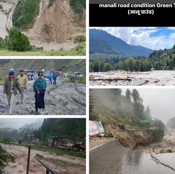
Normal Monsoon, Extraordinary Damage: PSPK dissects Himachal’s Growing Vulnerability- makes a call for concrete action
As many as 107 rain-related deaths and Rs 1,202 crore losses, still counting despite rainfall remaining within IMD’s normal range. What's wrong with Himachal Pradesh?
Shimla: Himachal Pradesh’s 2026 monsoon has delivered a warning that we at PSPK Green Spirituality believe the state can no longer afford to ignore. The state has received around 10 per cent less rainfall than normal between June 1 and August 31, yet has already recorded 107 deaths in rain-triggered disasters and losses of Rs 1,202.64 crore.
The figures show that disaster vulnerability is increasingly being determined not simply by the intensity of rainfall, but by what we have built, where we have built it and how we have altered the Himalayan landscape.
The India Meteorological Department considers rainfall between 19 per cent below and 19 per cent above normal to be within the normal range. By that definition, Himachal has experienced a normal monsoon so far this year, rather than either a drought or an exceptionally wet season.
PSPK observes that the significance lies precisely in the fact that substantial damage has occurred without extraordinary statewide rainfall.
June was 33 per cent deficient after the monsoon arrived late, while July recorded an 8 per cent surplus. August subsequently ended 16 per cent below normal, leaving the June-August seasonal rainfall around 10 per cent below normal. The statewide average, however, conceals a much more important geographical pattern.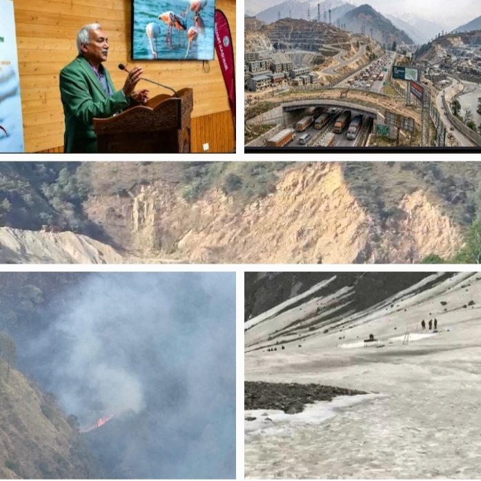
The largest deficits occurred in the cold-desert districts, where absolute rainfall is already comparatively low. Lahaul-Spiti was around 60 per cent below normal for the season, while Kinnaur recorded a deficit of around 58 per cent in August.
In contrast, Kullu and Shimla were around 14 per cent above normal for the season and Sirmaur recorded a 19 per cent surplus in August.
The more populated and landslide-prone mid-hills were therefore not suffering from a shortage of rain. These are also the areas where settlements, roads, tourism and infrastructure have expanded rapidly over fragile slopes and river valleys. We believe this makes land-use decisions as important to the disaster equation as rainfall itself.
As of September 2, the State Emergency Operations Centre had recorded 261 deaths during the season, including 107 in rain-triggered disasters and 154 in road accidents.
Overall financial losses had reached Rs 1,202.64 crore, with the Public Works Department alone accounting for Rs 914.76 crore. The monsoon, moreover, is not yet over, and a routine spell on September 2 put 150 roads out of service and disrupted 374 transformers.
2026 is lighter than 2025 — and that is the warning
We are not suggesting that 2026 compares with the devastation witnessed in 2025. That season ended with 454 deaths and Rs 4,881 crore in losses after 47 cloudbursts, 98 flash floods and 148 major landslides. Rainfall in 2025 was around 39 per cent above normal, the highest in 29 years.
On September 4, 2025, as many as 1,350 roads and five national highways were blocked simultaneously. The scale of that disaster was clearly linked to exceptional rainfall and repeated extreme events.
The comparison with 2026, however, raises a more uncomfortable question about the damage caused during an ordinary monsoon.
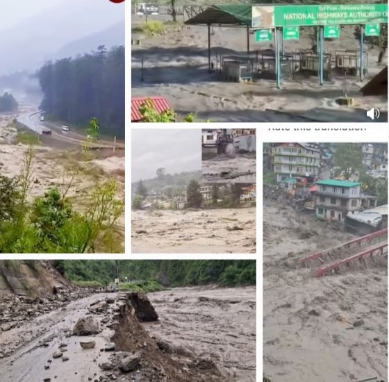
Himachal suffered losses of around Rs 1,151 crore in 2021 and Rs 939 crore in 2022. This year’s losses have already crossed both those figures despite rainfall remaining within the IMD’s normal band.
We need to examine whether ordinary monsoon conditions are now producing extraordinary consequences because of growing structural vulnerability.
Roads: cutting into mountains without respecting their limits
Himachal currently has around 2,592 km of national highways across 25 highways. Another 69 highways covering approximately 4,312 km have been approved in principle, much of the network passing through steep and geologically fragile Himalayan terrain. We cannot discuss this expansion without simultaneously discussing slope stability and cumulative ecological risk.
A 2015 landslide hazard assessment prepared for the state’s disaster management authorities identified around 60 per cent of Himachal’s road network as lying in landslide-vulnerable terrain.
Of the then 1,628 km of national highways assessed, 993 km fell in the high-vulnerability category. The state’s 2023 post-monsoon inventory subsequently mapped 13,569 landslides across Himachal.
Kangra accounted for 4,027 of those landslides, followed by Mandi with 2,169, Solan with 1,930 and Sirmaur with 1,395. These numbers show that landslides are not isolated events confined to a few notorious stretches. They are a systemic feature of a state in which roads increasingly intersect unstable slopes.
PSPK’s concern is therefore not simply the construction of roads, but the manner in which mountain slopes are modified.
On the Parwanoo-Solan four-laning corridor, sections of hills were excavated vertically to depths of 20 to 30 metres. The state’s own engineering assessments have identified stable excavation angles for Himalayan slopes in the range of approximately 48 to 75 degrees.
The Public Works Minister has acknowledged that vertical cutting allows boulders and debris to roll down during the rainy season. The Parwanoo-Solan corridor recorded 113 landslides in just 55 days during the 2023 monsoon.
Slope-protection work is now being undertaken at 42 critical sites on Parwanoo-Solan and another 28 on Solan-Kaithlighat.
We must therefore ask why relatively new roads are requiring extensive slope-retrofitting and protection. The issue is not whether Himachal needs better connectivity, because we clearly do. The issue is whether connectivity is being created in ways that remain compatible with the geological limits of the mountains.
The unresolved muck problem
Excavated muck represents another major concern associated with large-scale road construction. A 2017 CAG report found that only three of 20 approved dumping sites were operational.
This creates an obvious risk that material excavated from unstable slopes will eventually find its way into forests, streams, agricultural land and river channels.
In proceedings before the Himachal Pradesh High Court, NHAI acknowledged that of 6,41,256 cubic metres of excavated muck, 2,34,080 cubic metres had been dumped on private land.
The Forest Department has also imposed a Rs 1.15 crore penalty on NHAI for illegal dumping along the Ramshila-Manali stretch. Such findings underline the need for strict muck-disposal plans before excavation begins rather than corrective action after the damage.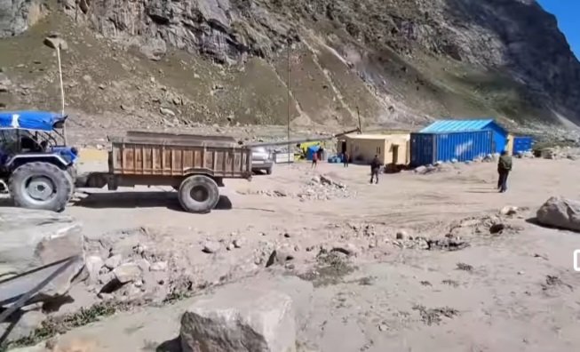
We acknowledge that the evidence is not uniform across every highway project. An NGT joint committee inspecting the Kiratpur-Nerchowk section in 2024 found no unauthorised hill cutting or illegal mining there.
PSPK’s position is therefore not that every road project is environmentally damaging, but that project-by-project compliance cannot substitute for landscape-level assessment.
The infrastructure damage nevertheless remains substantial. In 2025, around 10,642 km of 39,102 km of non-national-highway roads were severely damaged. Fourteen bridges were washed away and around Rs 3,010 crore was assessed as necessary for restoration.
Hydropower: development is increasing exposure
Himachal has an assessed hydropower potential of around 27,436 MW, with approximately 10,281 MW already commissioned through 29 large projects.
Hydropower is central to the state’s economy and energy strategy, but its expansion has to be assessed against the carrying capacity of Himalayan rivers. PSPK is particularly concerned about the cumulative impact of multiple projects operating within the same river basin.
HIMURJA’s published inventory contains 595 small hydropower projects of up to 5 MW, of which 109 have been commissioned.
The state cancelled 194 stalled projects in July 2025, another 15 in March 2026 and re-advertised 71 sites in April. We believe this repeated cycle of allotment, cancellation and re-allotment warrants a fresh cumulative ecological assessment.
Research from the Beas basin indicates that small and medium run-of-river schemes divert substantially more river length per megawatt than large projects.
On the Satluj, the planned cascade would leave more than 90 per cent of the river tunnelled or impounded, involving around 185 km of tunnels.
The Supreme Court in August 2025 also raised concerns about the condition of the Satluj and compliance with mandated minimum flows.
When power projects themselves become disaster victims
Hydropower infrastructure is increasingly exposed to floods, landslides and debris flows. Between July 25 and August 1, 2024, 14 hydropower projects were damaged and rendered non-operational, while at least eight workers died at Sumez.
These incidents demonstrate that disaster vulnerability can threaten both the environment and the infrastructure built to exploit it.
In June 2025, flooding disabled all four turbines of the 800-MW Parbati-II project. Parbati-III’s trash racks were also buried, while seven workers were killed at the 4.8-MW Indira Priyadarshini project in Kangra after a powerhouse located in a flood-prone area was hit. Malana-I has meanwhile suffered flash floods on August 1 in three consecutive years.
We must also account for glacial and landslide-dammed lakes. Around 2,292 glacial lakes have been identified in the Sutlej basin, including approximately 1,335 in Tibet and beyond India’s direct monitoring capability.
The State Centre on Climate Change has identified 67 lakes larger than 10 hectares, while the NDMA has identified four as high-risk.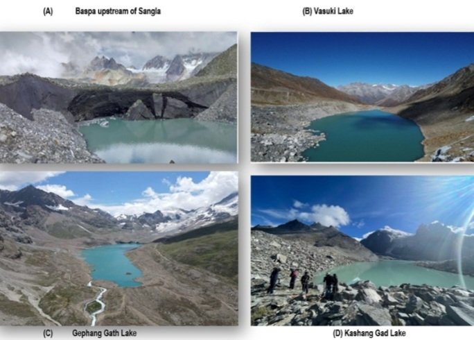
Early-warning systems are being developed at four sites. Officials have, however, identified poor network connectivity as a major obstacle.
PSPK believes early warning must be treated as essential infrastructure in a state where communities and critical projects lie downstream of potentially dangerous lakes and unstable slopes.
Mining: treating riverbeds as a balance sheet
Himachal has 448 registered stone crushers and 551 mining leases. Between 2022-23 and 2024-25, the state recorded 29,276 illegal mining cases and collected Rs 18.33 crore in penalties. This translates into roughly 27 cases every day, raising serious questions about the effectiveness of existing enforcement.
The Mineral Policy, 2024, doubled the permitted depth of riverbed excavation from one metre to two metres. PSPK believes such extraction requires particularly close scientific monitoring because riverbeds are not simply sources of construction material but integral parts of flood management and groundwater systems.
Disturbing their geometry can alter river velocity, bank stability and the vulnerability of bridges and adjoining settlements.
At Kala Amb in Sirmaur, mining has reportedly eroded bridge foundations on the Markanda by around 40 feet. On the Chakki, ravines as deep as 100 feet developed beneath a railway bridge that collapsed in August 2022. The Railways had complained about mining-related damage, while district authorities attributed the collapse to the age of the structure.
In the Beas basin, 68 of 131 crushers were found without the required permissions. In August 2023, the state shut 129 of around 300 active crushers in the basin. The Chief Minister at the time described the transformation of the ecosystem as alarming.
We also see a troubling gap between official documentation and conditions on the ground. The 2024 Sirmaur District Survey Report states that no significant change in the river profile had been observed and that floodwaters refill excavated pits, yet it contains no specific data row for the Markanda.
In May 2025, the NGT took up a complaint alleging that around 250 acres of irrigated land in Salani Katola were becoming barren as the water table fell near crusher operations.
Khads and floodplains: the missing line on the map
The most fundamental regulatory gap may concern construction close to rivers, khads and nallahs. The Himachal Pradesh Town and Country Planning Rules, 2014 require development plans to show nallahs, but do not establish a uniform statewide minimum setback from a nallah, khad or river. Specific development plans may prescribe setbacks, but these do not cover the entire state.
Himachal has also not enacted comprehensive floodplain zoning legislation. The state has an estimated 2.87 million hectares of flood-prone area, yet there is no comprehensive statutory mechanism demarcating floodplains and restricting construction within them.
PSPK believes this gap becomes increasingly dangerous as settlements expand into river valleys and natural drainage channels.
More than 80 per cent of Himachal is rural, and historically large parts of these areas remained outside the Town and Country Planning Act. The post-disaster needs assessment following the 2023 catastrophe acknowledged the absence of mandatory building bye-laws and permit systems across large rural areas. The state has since moved towards extending regulatory coverage, but implementation remains the critical challenge.
The consequences were visible at Thunag in Mandi on June 30, 2025, when 140.7 mm of rainfall fell in 24 hours. Forty-eight houses were destroyed and 73 shops were wiped out. The event demonstrated how rapidly settlements located close to active drainage channels can become vulnerable when intense rainfall occurs.
A Himachal Pradesh University study published in August 2026 found that encroachment on active floodplains was a stronger predictor of damage than building quality. Satellite imagery showed progressive loss of riparian buffers and narrowing of channels. PSPK believes this finding should become central to future land-use planning across the state.
The state has announced proposed setbacks of 100 metres from rivers for houses and 150 metres for government buildings. Model rural building bye-laws were also cleared in September 2025. But we need a notified floodplain, a demarcated buffer and an enforceable prohibition on construction in high-risk zones rather than policies that remain largely aspirational.
Tourism: when carrying capacity becomes an afterthought
Himachal recorded approximately 3.11 crore tourist arrivals in 2025 against a resident population of around 75 lakh. Tourism contributes around 7.77 per cent of state GSDP and is therefore economically indispensable. At the same time, the physical pressure created by tourist traffic must be reconciled with the limited carrying capacity of mountain towns and valleys.
The tourist-arrival figures need to be interpreted carefully because religious tourism accounts for a substantial share and changes in counting methodology may have contributed to the increase. Vehicle movement provides a clearer indication of physical pressure on roads and settlements. More than 15 lakh vehicles entered Shimla between May 1 and June 15, 2026, equivalent to roughly 33,000 vehicles a day.
Shimla is already constrained by steep terrain, high density and inadequate infrastructure. Parts of the core area have densities of 2,500 to 3,500 persons per hectare against a recommended hill-settlement density of around 450. Water demand of approximately 47-48 MLD has also been met against supply of about 33 MLD.
The pressure extends beyond Shimla. The Atal Tunnel, designed for around 4,500 vehicles a day, has recorded peak 24-hour traffic of 7,500 to 10,000 vehicles. Manali’s waste generation more than doubles during the tourist season from around 30 tonnes to 70 tonnes a day, while 20 urban local bodies in the state have no sewage facility.
Carrying capacity cannot be calculated after saturation
The regulatory history of Shimla is instructive. The NGT in 2017 held that Shimla had exceeded its carrying capacity and imposed restrictions on construction and development. Subsequent planning decisions expanded permissible construction, while the Supreme Court upheld the Development Plan 2041 in January 2024 after finding sufficient safeguards.
A later notification allowing buildings of up to 20 storeys in central business districts was stayed by the High Court. At the same time, Himachal is moving ahead with 28 approved ropeway projects, including seven Parvatmala projects worth around Rs 3,232 crore. The proposed destinations include Bijli Mahadev, Shikari Devi, Kheerganga and Hamta.
The state has 4,289 registered homestays and an estimated 3,000 additional unregistered establishments. Where carrying capacity has actually been calculated, the numbers are sobering. The NGT capped Kufri at 2,232 tourists a day and 293 horses, while the destination had reportedly been receiving between 700 and 800 visitors.
PSPK believes carrying capacity must become a prerequisite rather than an afterthought. Every major tourist destination should have scientifically determined limits for visitors, vehicles, water consumption, waste generation and construction. Infrastructure expansion should follow those limits rather than determine them.
The common thread: we know the risks
Our assessment is not that Himachal lacks knowledge of its vulnerabilities. We have geological maps, landslide inventories, disaster assessments, CAG reports, cumulative impact studies, glacial lake inventories and carrying-capacity assessments. The problem is that this knowledge has not consistently translated into binding development limits.
The Geological Survey of India has mapped landslide susceptibility and places Himachal among India’s most vulnerable states.
Around 26 per cent of the state’s area falls in the high-susceptibility category, rising to 42.86 per cent in Chamba and 39.93 per cent in Kinnaur. These are not abstract statistics but indicators of the physical limits within which development must take place.
The State Centre on Climate Change has documented landslides and glacial hazards. The CAG has highlighted shortcomings in muck disposal, while the NDMA has identified high-risk glacial lakes. The information exists, but the regulatory system often lacks a clear line beyond which development cannot proceed.
We need a statutory floodplain, a mandatory setback from khads and rivers, enforceable slope-cutting standards and carrying capacity determined before destinations are saturated.
We also need cumulative assessments before multiple hydropower projects are placed on the same river and scientific limits on extraction from riverbeds. These are not anti-development measures; they are conditions for sustainable development in a Himalayan state.
The warning from 2026
In August 2026, the Himachal Pradesh High Court, acting on its own motion, suspended pending forest clearances for new roads and tarring towards Chandertal, Shikari Devi and Churdhar.
The court’s intervention reflected concerns that road permissions could open ecologically sensitive areas to increasing tourist pressure. We welcome such scrutiny, but regulation should ideally precede environmental damage rather than follow it.
Nepal’s recent disaster in the Trishuli and Bhote Koshi valleys provides another stark Himalayan reminder of what can happen when infrastructure, extreme events and fragile terrain collide.
We do not suggest that Himachal will necessarily experience an identical disaster. Our concern is that many of the underlying vulnerabilities — unstable slopes, river corridors, hydropower infrastructure and expanding settlements — are shared across the Himalayan region.
The 2026 monsoon has not been extraordinary by rainfall standards. Yet it has already produced 107 rain-related deaths and Rs 1,202.64 crore in losses. PSPK believes that should force us to look beyond the weather and examine the decisions that have converted natural hazards into recurring disasters.
We cannot prevent every cloudburst, landslide or flood. We can, however, determine where roads are cut, where muck is dumped, where rivers are mined, where powerhouses are built and where settlements are permitted. We can also decide how much tourism a fragile mountain destination can safely carry. That is where the real test of governance lies.
The mountains will continue to receive rain. Our roads, rivers, slopes, towns and infrastructure must therefore be designed to survive it.
PSPK Green Spirituality believes the lesson of this “normal” monsoon is clear: we do not need to wait for another 2025 or 2023 before changing the way we build in Himachal Pradesh.
(Atul Kaushik is a retired Major General of the Indian Army and currently serves as Chief Executive of PSPK Green Spirituality, an environmental organisation focused on Himalayan ecological conservation. 
His work and writing reflect a strong interest in the region’s fragile ecology, environmental challenges and sustainable development.
Views expressed are his own.)
RESPONSES:
1 This is all due to the casual attitude to the global scientists observations on climate change. Our production of carbon dioxide has touched the alarming levels and no body is controlling it. I hope clean energy is the best alternative to it. In Himachal, we don't go for a multidisciplinary approach. The erratic pattern of monsoon is very much related to climate in Indian pan insula. We lack water harvesting techniques to fight this problem. We plan roads, industries, minings, etc without considering the impact on geological strata of the area. I don't mean no development but it should be overall by paying full consideration to the ecosystem. If we have to plan a road, we must take care by doing very little loss to the ecology of the area. The construction and stabilization work should go side by side. The road can only function well if it is on solid and stable strata. We construct roads first and wait for its stabilization with time, which is very dangerous. It is an invitation to disasters. Nature has sufficient for our needs but not for our greed. We dig out the sites for longer distances and don't bother for its stabilization. The erratic behaviour of monsoons has to be properly studied and we have to reduce the production of carbon dioxide and other global warming gases. Solar energy, wind energy, hydrogen fuel, etc may be considered as alternative energy resources.
-Dr. KULWANT RAI, SCIENTIST AT HFRI
2. A very timely and comprehensive article by Major General Atul Kausik (Retd.) highlighting the serious ecological and developmental challenges facing Himachal Pradesh.
The reported ₹1,200 crore losses and 107 rain-related deaths in 2026, despite rainfall remaining within the IMD’s normal range, are a matter of grave concern. This calls for an urgent reassessment of major projects, including hydropower, four-laning, roads, airports and commercial construction, keeping the carrying capacity of fragile areas in mind.
Strict enforcement of existing environmental, forest, TCP and disaster-management laws is essential. The State Government should consider scientifically identifying No-Construction and Regulated-Construction Zones to balance development with ecological stability.
Sustainable development must not come at the cost of Himachal’s ecology. People’s participation and accountability are essential for protecting the State for future generations.
-D.K. MANTA, HAS (Retd.)
LIFE MEMBER, IIPA, NEW DELHI
SHIMLA
3. A well-articulated article that touches the real issues confronting Himachal Pradesh. The monsoon brings new episodes of damage every year; clearly, we need to move beyond crisis management and look for lasting solutions.
Community participation has to be at the heart of this effort. We are all stakeholders. The Government alone cannot control or effectively manage the crisis created by extreme monsoon events.
Planning, strategy and implementation must involve local communities. Scientific geological surveys should precede roads, buildings and other infrastructure projects, with community knowledge factored in—people understand local water movement, slopes, springs, wells and baoris far better than outsiders often do.
Large-scale plantation along roads, lanes, around government buildings and other infrastructure can also strengthen slopes and improve water management. Illegal dumping by contractors often continues because communities remain silent. An empowered and vigilant community can act as the first line of accountability.
The way forward is therefore clear: scientific planning + responsible execution + active community participation. Only then can we build a more resilient Himachal.
- PREM PAL RANTA, FORMER DISTRICT AND SESSIONS JUDGE, SHIMLA