
Heavy Rain Alert in Himachal for Next 5 Days! Farmers, Tourists, and Rescue Teams on High Alert
SDRF and local administrations warned; risk of renewed devastation in Seraj valley
Shimla, July 13, 2025 –
The weather in Himachal Pradesh is expected to turn rough in the coming days. According to the latest Bulletin No. 196 issued by the Meteorological Centre Shimla, widespread light to moderate rainfall with spells of heavy to very heavy rain is likely from July 14 to 17, especially in districts already affected by floods and landslides — including Seraj valley, Kangra, Mandi, Solan, Sirmaur, Shimla, and Chamba.
Farmers and Tourists Cautioned
The IMD has advised farmers to take precautionary measures to protect their standing crops and orchards from waterlogging, mudslides, and storm-related damage.
Tourists have been warned against trekking or traveling to high-altitude or landslide-prone areas, particularly in Shimla, Kinnaur, Lahaul-Spiti, and parts of Kullu and Chamba.
Seraj Valley
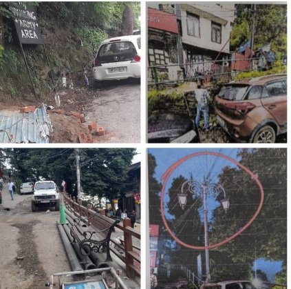
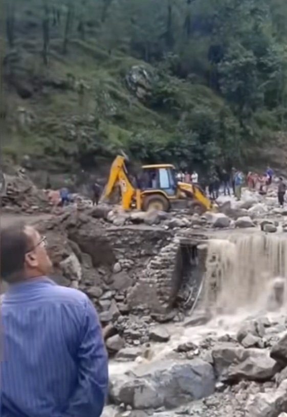
Fresh rainfall is likely to worsen conditions in Seraj valley, which is already reeling under flood devastation.
Rescue operations are ongoing, and the State Disaster Response Force (SDRF) has been alerted to prepare for any emergency evacuations.
Local administration fears more landslides, road blockages, and flash floods in vulnerable areas.
Districts on High Rainfall Alert:
July 14: Very heavy rain at isolated places in Kangra and Sirmaur
July 15–17: Heavy rain spells in Shimla, Solan, Chamba, Kullu, Mandi, and Sirmaur
Lahaul-Spiti and Kinnaur: Light to moderate rain expected, but these areas are highly sensitive due to fragile terrain
Likely Impacts:
Landslides and mudslides in hilly terrain
Waterlogging in low-lying areas
Disruption in essential services and traffic congestion
Risk of flash floods and sudden rise in river/nallah water levels
Partial damage to kutcha houses, roads, and orchard infrastructure
Danger of skidding on slippery roads and poor visibility
Authorities Advise:
Avoid travel to landslide-prone and low-lying flood-risk areas
Stay away from rivers and rivulets during intense rainfall
Postpone trekking and outdoor activities in hills
Follow traffic and weather advisories strictly
Be prepared for sudden road closures and infrastructure breakdowns
With no warning issued for July 13, the real spell of trouble is expected to begin from July 14 onwards, with July 16 likely to witness the most widespread impact.
Stay updated, stay safe.